Bleed Map: Saving Lives Through Access - Now Signposted in imabi Travel Guardian app
In an emergency, every second matters and knowing where to find a bleed control kit can be the difference between life and death.
That’s exactly what Bleed Map is working to solve.
What is Bleed Map?
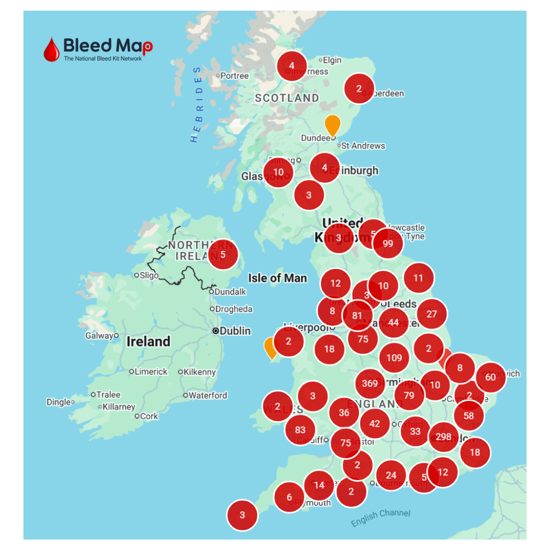
Bleed Map is a growing UK initiative dedicated to identifying and mapping publicly accessible bleed control kits, making bleed control kits visible, accessible, and easy to find in an emergency.
Bleed control kits are often placed in public spaces such as:
Train stations 🚆
Shopping centres 🏬
Night-time economy venues 🍸
Community hubs 🏫
The kits contain life-saving equipment designed to help control severe bleeding before emergency services arrive.
How Does Bleed Map Work in Practice?
Bleed Map crowdsources and verifies the locations of publicly accessible bleed control kits, creating a central, searchable map for the UK.
In practice, this means:
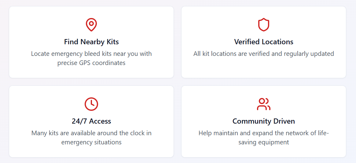
📍 Users can search for nearby bleed kits based on their location
🧭 Locations are mapped and continuously updated
🤝 Communities and organisations can contribute by registering new kit locations
🚨 In an emergency, people don’t waste time guessing - they can act quickly
It’s about removing uncertainty at the exact moment clarity is needed most.
In an emergency always call 999
In situations involving serious injury, particularly those linked to accidents or violence, rapid access to these kits can be the difference between life and death.
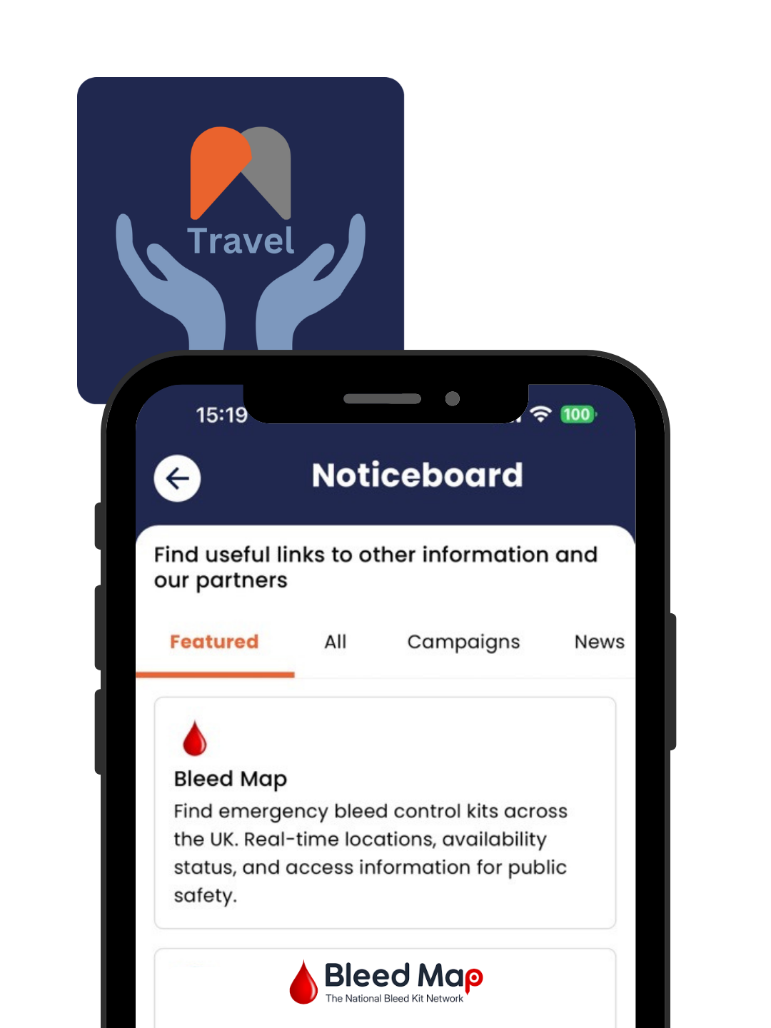
That’s why Bleed Map is now being signposted within the Noticeboard feature of the imabi Travel Guardian app, helping users discover this important resource as part of their everyday safety toolkit, ensuring that:
More people are aware of where bleed kits exist
Life-saving information is easier to access on the move
Communities are better connected to critical safety resources
By bringing together platforms like Travel Guardian and initiatives like Bleed Map, there is a real opportunity to create smarter, more connected public safety ecosystems.